



SUPERPOWER FORESTS: Classifying and Mapping Mangrove Areas in Bulakan, Bulacan using Deep Learning Model
By Josh Tabernilla, Technical Marketing Specialist
Geospectrum Remote Sensing | Sept 14, 2025
READ TIME: 7 MINUTES
INTRODUCTION
Anywhere in the world, mangroves have been regarded as robust “rainforest of the
sea” [1] and “ecosystems of hope”[2] as they are critical in maintaining a
rich marine biodiversity
of a variety of plants and animals as well as providing inhabitants along coastal areas with food,
livelihood, and fortified shelters.
A recent study noted that mangroves have the following four-fold characteristics that make them a
special superpower ecosystem: “high productivity, high return rate, high decomposition rate, and
high resistance to extreme weather events such as storms, floods and tsunamis” [3]. What
this means
is that mangroves can store excess atmospheric carbon at a rate ten times greater than tropical
forests, helping mitigate impacts of climate change [4]. They also act as a filter of
pollutants
originating from upland soil before reaching seagrass habitats and coral reefs [5].
Interestingly,
in a country like the Philippines, mangrove forests also act as natural barriers by stabilizing
coastlines and preventing erosion during storm surges and cataclysmic typhoons [6].
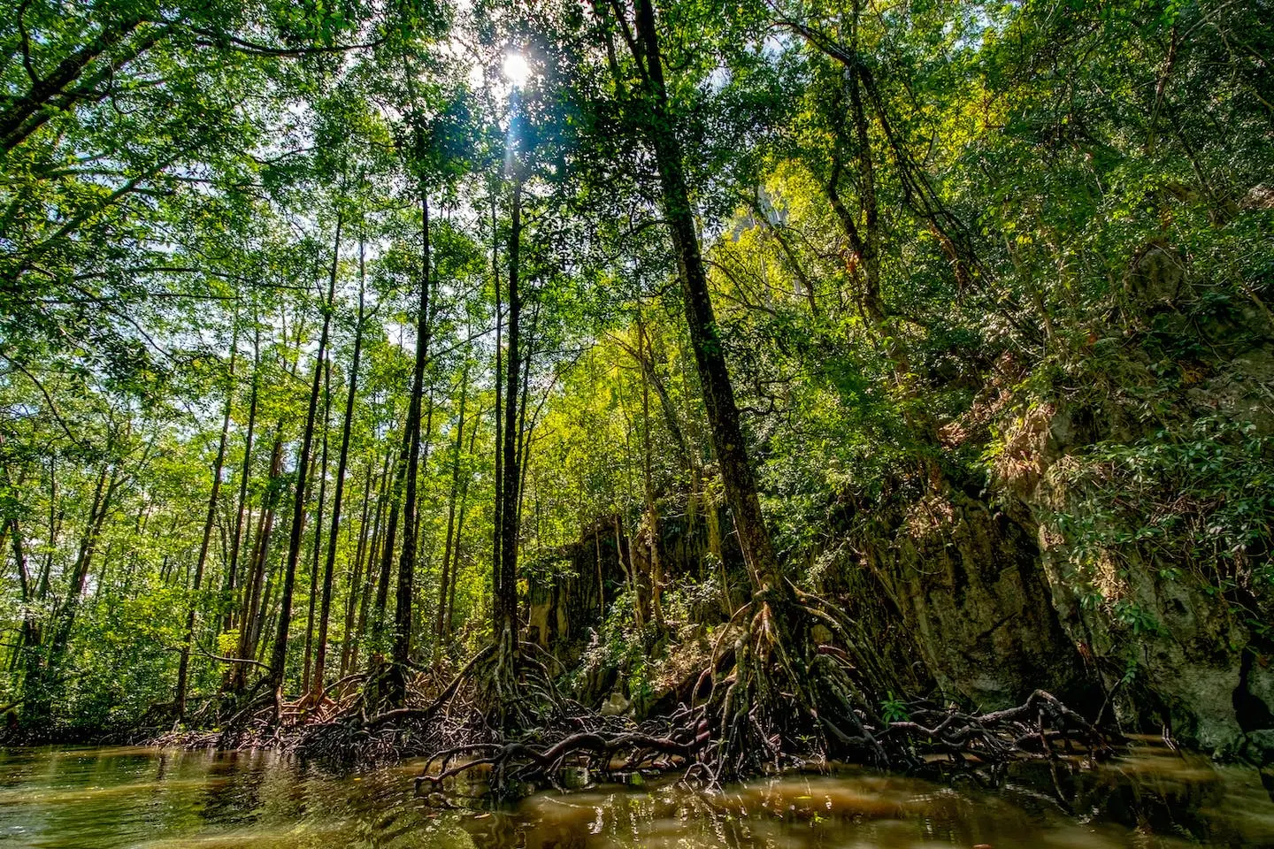
Figure 1: Mangrove forest in Palawan, Philippines; Source: Website post by Green Gecko, Philippines Island Hopping
Unfortunately, Global Mangrove Watch (GMW) reported that mangrove areas have been shrinking in
number due to both natural but mostly human-induced activities, signalling a significant threat to
relevant ecosystems, global climate, and people’s livelihood [7].
For instance, as of this blog’s publication, around 300,000 hectares of mangrove area is estimated
to be present in the Philippines [8]. History reveals, however, that a staggering 49%
decrease
nationwide in terms of size in hectares was recorded for years comparing 1920 and 2019 through
Sentinel 2-based mangrove vegetation index (MVI) [9]. Thus while efforts to conserve
mangroves
exist, challenges to sustain them still remain which further pushes the question on how we can
leverage technology like GIS and remote sensing to contribute to said efforts.
METHODS AND RESULTS
In view of the situation of existing mangroves in the country, Geospectrum decided to classify mangrove areas within the vicinity of New Manila International Airport (NMIA) in Bulakan, Bulacan for the year 2024. In choosing this location, understanding the context in Bulacan was necessary, given the reports that flood occurrences in Bulacan could persist from 2024 due to high subsidence rate from 2014 to 2020 [10]. At the same time, Geospectrum operated under the principle that monitoring and conserving mangroves as a natural tool for flood protection around NMIA would greatly benefit the local residents and the airport management in Bulacan.
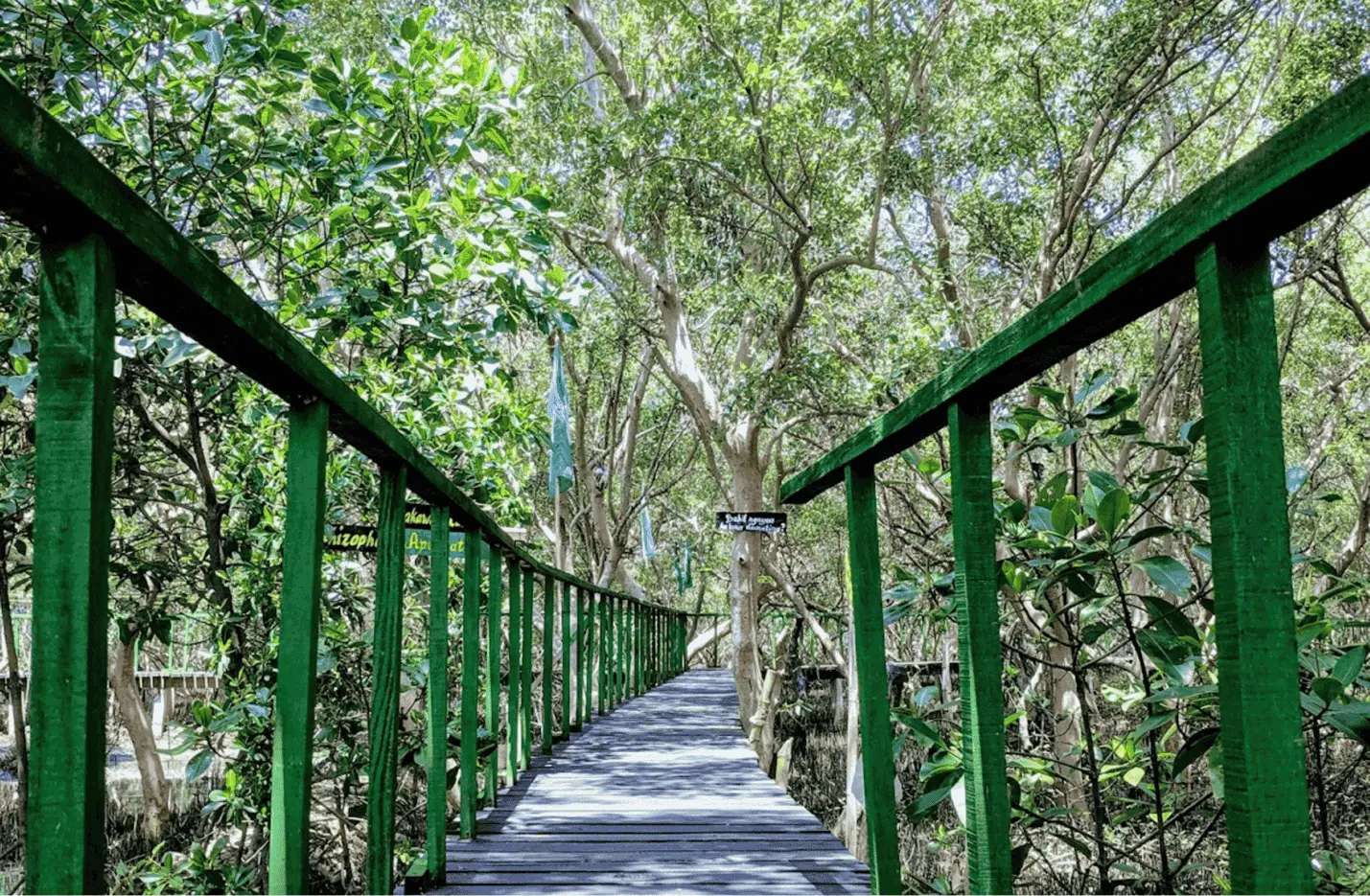
Figure 2: Bulakan Mangrove Ecopark in Bulakan, Bulacan, Philippines; Source: Facebook Album by Kit De Gala
To carry out our objectives, we used ArcGIS Pro as our processing software with
PlanetScope satellite imagery as our data input.
As our first step, we marked certain locations of mangroves by digitizing areas of mangrove forests
manually which we used to train the model in detecting similar patterns and textures. After the
training data was extracted, we converted this into what is called “image chips” or smaller tiles
containing the object of interest that would be used to train the model. We then developed and
trained different models with different number of epochs or iterations, i.e., 100, 300, 500, with
ResNet-34 with UnetClassifier chosen as the backbone model based on the study conducted by Cao and
Zhang [11]. Lastly, after a week of developing the model, we chose the most accurate output map of
classified mangroves based on the training and validation loss graph as shown in Figure 3.
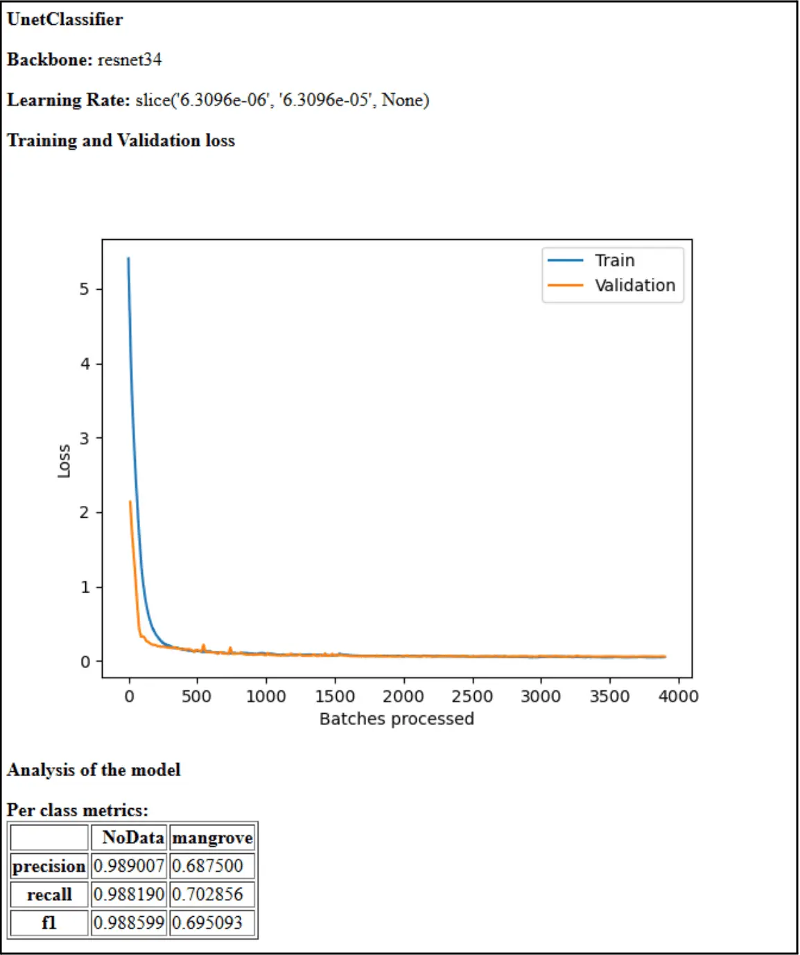
Figure 3: Validation Graph using ResNet-34 with 300 epoch, displaying a graph of the amount of error that was present as the model trained over time.
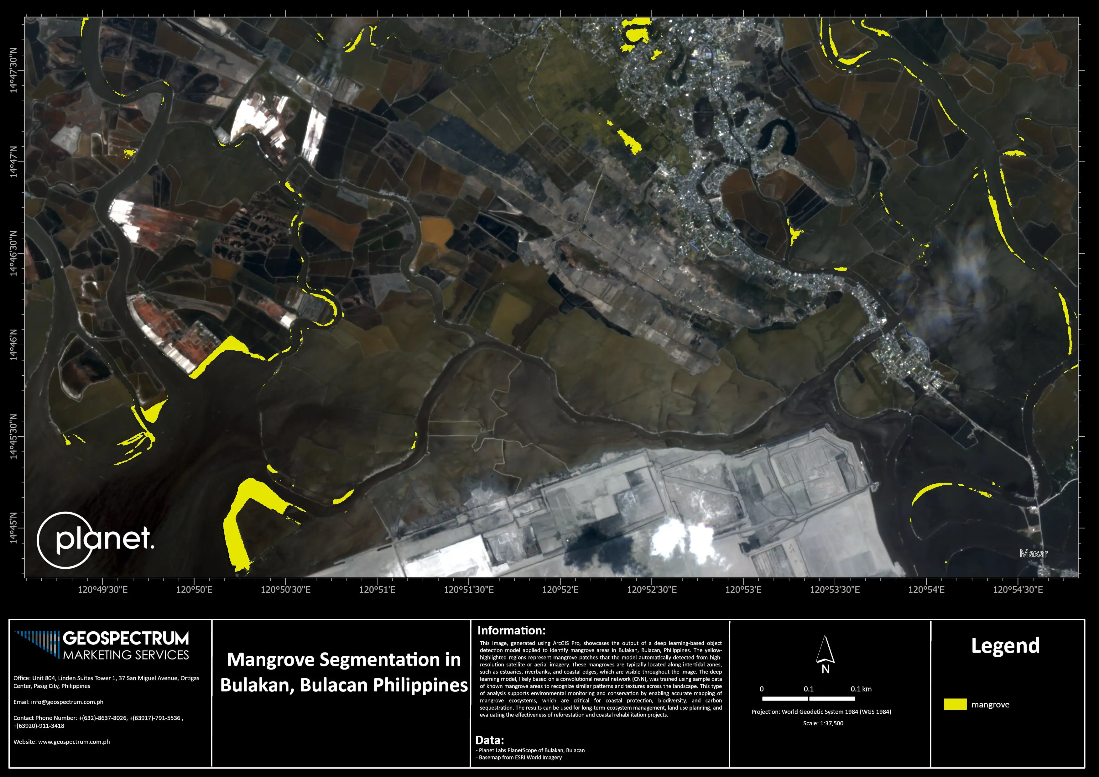
Figure 4: Final Output Map for the Mangrove Segmentation in Bulakan, Bulacan, Philippines.
As a result, we found that the ResNet-34 with UnetClassifier model type with 300 epoch was the most precise with 98% and detected 68% of mangroves in the satellite image that was provided. It also has a recall of 98% with 70% corrected truth. Figure 4 displays the final output map of the deep learning model, with those shaded in green as the classified mangroves. This map, subject to ground validation, provides a preliminary but thorough visual information necessary for assessing and improving conservation and rehabilitation efforts of mangrove forests. Comparing mangrove extents is also possible once previous and future datasets are obtained.
CONCLUSION
Rich geospatial data and relevant spatial analysis are proven useful in monitoring mangrove areas and classifying them through a deep learning model. This approach, coupled with GIS and remote sensing techniques, allows for the realization of beneficial use cases including long-term ecological management, land use planning, and effective coastal rehabilitation efforts. Geospectrum can further integrate a web-based monitoring of mangrove plantations that can also be achieved via deep learning classification with ArcGIS Dashboards or Experience Builder, serving as a customizable visualization tool in learning critical information for conservation groups, nearby infrastructure developers, and local government units alike. Here at Geospectrum, we have a team of dedicated people who specialize in geospatial data analysis which allow us to produce life-altering solutions by leveraging the use of satellite imagery. Our company can provide your organization with up-to-date models and high-resolution maps to help you achieve your full potential against the backdrop of an ever-changing world. To get in touch with our team of solution providers, you may send us an email at info@geospectrum.com.ph. You may also visit our website at www.geospectrum.com.ph to learn more about the products and services we offer.
References:
[1] DENR-ERDB calls for abstract, research papers for the First ASEAN Congress on Mangrove R & D
slated in Manila on December 3-7, 2012. DENR. (2012, June 19).
https://denr.gov.ph/news-events/denr-erdb-calls-for-abstract-research-papers-for-the-first-asean-congress-on-mangrove-r-d-slated-in-manila-on-december-3-7-2012/.
[2] Leal , M., & Spalding, M. D. (2022). The State of the World’s Mangroves 2022. Global Mangrove
Alliance.
https://www.mangrovealliance.org/wp-content/uploads/2022/09/The-State-of-the-Worlds-Mangroves-Report_2022.pdf.
[3] Choudhary , B., Dhar, V., & Pawase, A. S. (2024). Blue carbon and the role of mangroves in
carbon sequestration: Its mechanisms, estimation, human impacts and conservation strategies for
economic incentives. Journal of Sea Research, 199-2024 (102504), 1–22.
https://doi.org/10.1016/j.seares.2024.102504.
[4] NOAA. (2023, August 16). Coastal Blue Carbon. NOAA’s National Ocean Service.
https://oceanservice.noaa.gov/ecosystems/coastal-blue-carbon/.
[5] Martin, C., Almahasheer, H., & Duarte, C. M. (2019). Mangrove forests as traps for marine
litter. Environmental Pollution, 247, 499–508. https://doi.org/10.1016/j.envpol.2019.01.067.
[6] Martin, B. (2018, November 8). Philippine mangroves fight floods & provide livelihoods. Green
Economy Coalition.
https://www.greeneconomycoalition.org/news-and-resources/philippine-mangroves-fight-floods.
[7] Cooper, C. (2022, November 8). Mangrove forest loss is slowing toward a halt, new report shows.
Mongabay Environmental News.
https://news.mongabay.com/2022/11/mangrove-forest-loss-is-slowing-toward-a-halt-new-report-shows/.
[8] Keynote Speech of DENR Secretary Maria Antonia Yulo-Loyzaga (During the Mangrove Map Validation
Launch, 28 February 2024, DENR Social Hall, Q.C.). (2024, February 28). DENR.
https://denr.gov.ph/secretarys-corner/kyenote-speech-of-enr-secretary-maria-antonia-yulo-loyzaga-during-the-mangrove-map-validation-launch-28-february-2024-denr-social-hall-q-c/.
[9] Agduma, A. R., & Cao, K.-F. (2028). Species richness, extent and potential threats to mangroves
of Sarangani Bay Protected Seascape, Philippines. Biodiversity Data Journal, 11: e100050.
https://doi.org/10.3897/BDJ.11.e100050.
[10] Sulapas, J. S., Ybañez, A. B., Milcah, K., Marie, J., & Mahar, A. (2024). Ground subsidence in
major Philippine metropolitan cities from 2014 to 2020. International Journal of Applied Earth
Observation and Geoinformation, 133, 104107–104107. https://doi.org/10.1016/j.jag.2024.104107.
[11] Cao, K., & Zhang, X. (2020). An Improved Res-UNet Model for Tree Species Classification Using
Airborne High-Resolution Images. Remote Sensing, 12(7), 1128. https://doi.org/10.3390/rs12071128.
