×
MENU connect with us
CONTACT US
PRODUCTS
WHAT WE OFFER
GEOSPECTRUM caters to the growing need for accurate, up-to-date and timely geospatial information to support decision making and planning activities. We distribute high-resolution, high cadence (monthly, weekly and daily revisit) satellite imagery and value-added products that address a wide range of applications.


Whether you are:
geospectrum agricultute
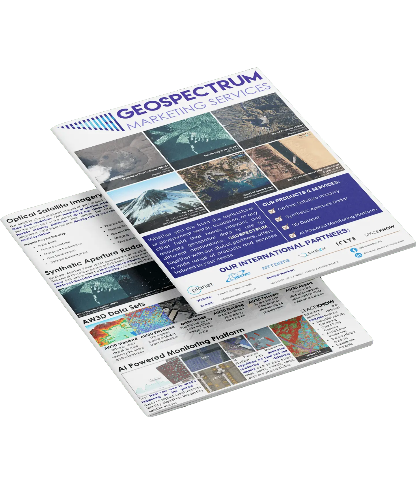
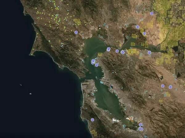
From the agricultural sector looking for timely satellite imagery for crop monitoring
geospectrum goveernment
From the government needing spatial data for better resource management
geospectrum academe
From the academe trying to do innovative research that will contribute to the development of our country
geospectrum private sector
From any sector that needs relevant and accurate geospatial data to be used for your applications
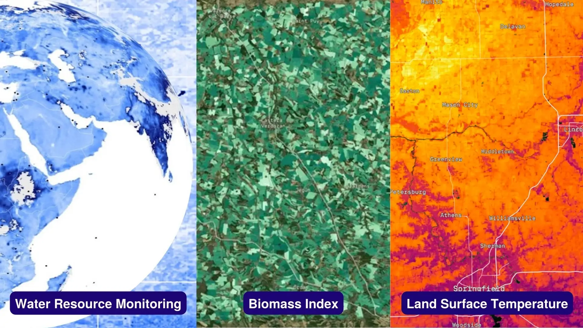
 
Geospectrum, together with its global partners, offers a wide
range of products that are tailor fit according to your needs.

Geospectrum, together with its global partners, offers a wide
range of products that are tailor fit according to your needs.

OPTICAL SATELLITE IMAGERY

 
01.01
PLANET MONITORING
 
 
PLANET MONITORING
Persistent broad-area monitoring at 3.7m resolution for timely insights about any location on Earth, easily accessible on the web.
 
01.02
PLANET TASKING WITH SKYSAT
 
 
PLANET TASKING WITH SKYSAT
Empowers organizations with global access to high-frequency, very-high-resolution (50 cm) imagery on their own terms, giving them intelligence and visibility multiple times per day.
 
01.03
PLANET VARIABLES
 
 
PLANETARY VARIABLES
Enhance your decision-making processes across diverse industries with tools driven by consistent observations and supported by an extensive archive spanning decades. Utilizing satellite data from Planet allows us to monitor key indicators crucial for assessing the well-being of our planet, including water levels, vegetation health, temperature variations, and forest carbon content.
 
01.04
Very High-Resolution Pelican
 
 
Pelican
In a rapidly evolving and competitive operational landscape, defense and intelligence organizations require up-to-date, precise, and pertinent insights to effectively prepare for and respond to future challenges. Depending on static or incomplete information is no longer viable, as unforeseen events not only pose strategic risks but also result in missed opportunities.

Pelican improves the capabilities of Planet’s high-resolution SkySat such as faster delivery of data, allow for better resolution to see finer details, and add more ways to combine insights with other analytics and sensors.

 
01.05
TANAGER
 
 
TANAGER
Planet's forthcoming hyperspectral satellite constellation is intended to provide customers with a level of detail that is unprecedented, enabling them to uncover social, environmental and climate risks. The Hyperspectral Offering, which is set to launch in 2023, will help businesses and governments change the way they perceive human activities and their economic and environmental effects.

 
01.06
MULTI-SPECTRAL
 
 
MULTI-SPECTRAL
Satellogic's multispectral sensor is equipped with four bands (red, green, blue and near-infrared), covering a range of wavelengths from 450 to 900 nanometers. The camera's ground sampling distance (GSD) is 1 meter, and its swath width is 5 kilometers.

 
01.07
HYPER-SPECTRAL
 
 
HYPER-SPECTRAL
Satellogic’s hyperspectral cameras gather imagery data with a resolution of 25 meters while orbiting the Earth at an altitude of approximately 475 kilometers. The cameras capture data in 29 spectral bands ranging from visible to near-infrared wavelengths (460 - 830nm), and the resulting imagery is ortho-rectified and ready for use in Geographic Information Systems (GIS).

NON-OPTICAL SATELLITE IMAGERY

 
02.01
ICEYE SYNTHETIC APERTURE RADAR DATA
 
 
ICEYE SYNTHETIC APERTURE RADAR DATA
ICEYE is revolutionizing synthetic aperture radar (SAR) technology with its small and agile SAR satellites, which are capable of revisiting the same location on Earth daily and even sub-daily. Unlike traditional SAR satellites, ICEYE's satellites are small and carry unique antennas that enable them to scan areas up to 50,000 km² in lower resolution and zoom into areas at a much higher resolution. With the world's largest SAR constellation, ICEYE provides unlimited global access and the highest frequency revisits on the market, measured in hours instead of days.
 
02.02
ALOS 2
 
 
ALOS 2
ALOS-2, also known as "DAICHI-2," is an improved version of the ALOS Daichi mission launched in 2006. ALOS-2's state-of-the-art Synthetic Aperture Radar can observe day and night and in all weather conditions and archiving images since 2009.

ANALYTICS SERVICES AND SOFTWARE

 
03.01
AW3D STANDARD
 
 
AW3D STANDARD
AW3D Standard is the world's best global digital elevation model (DEM). More than 3 million satellite imageries are used to create the most comprehensive high resolution digital 3D imagery today. Global coverage, short delivery and low cost.
 
03.02
AW3D Enhanced
 
 
AW3D Enhanced
AW3D Enhanced is the highest precision DEM, available in 0.5 to 2m resolution. This can provide terrain models with such high resolution that detailed variations in tree height can be determined.
 
03.02
AW3D BUILDING
 
 
AW3D BUILDING
AW3D Building is a highly scalable, cost-effective, reliable, and user-friendly vector data geodata product suited for project management, disaster simulation, urban planning and others.
 
03.03
AW3D ORTHO IMAGERY
 
 
AW3D ORTHO IMAGERY
AW3D Ortho Imagery is the highest quality orthorectified imagery, comprised of high-resolution satellite images from any area on the planet, which are then orthorectified using AW3D Standard/Enhanced.
 
03.04
AW3D AIRPORT
 
 
AW3D AIRPORT
AW3D Airport or eTOD (Electronic Terrain & Obstacle Data) is derived from high-resolution satellite imagery. This data is essential for plane take-off and landing procedures, as well as for airport facility management. AW3D Airport helps reduce the cost of updating obstacle data related to facilities, buildings, or tower lines around the airport, ensuring compliance with international aviation standards.

 
03.05
AW3D TELECOM
 
 
AW3D TELECOM
AW3D Telecom is a high-accuracy, low-cost, and wide-coverage 3D digital map designed for 5G networks, compatible with globally standardized wireless network design software used for signal propagation and radio frequency (RF) simulation. Sources from multiple imagery types contribute to the highest accuracy, including vector data for buildings, vegetation, and bridges.

 
03.06
SPACEKNOW
 
 
SPACEKNOW
SpaceKnow provides global coverage of the earth through cutting-edge technology giving you access to view specific locations and monitor trends in our planet, empowering decision-makers with ultra-large-scale planetary analysis.

 
03.07
SEEDS FOR LGU
 
 
SEEDS FOR LGU
The Social Economic Environmental and Demographic Systems for LGU, or SEEDs for LGU, is a web GIS portal that provides Local Government Units (LGUs) a tool to effectively utilize spatial and textual information about and within their locality. It aims to provide a comprehensive visualization and analysis of data gathered from existing LGU data repositories, enabling them to query and analyze their locational information and assist them in providing efficient social services and enhancing development planning.

 
03.08
PATIENT CONSULTATION INFORMATION SYSTEM
 
 
PCIS
Patient Consultation Information Systems, or PCIS, is a web portal and desktop application that provides medical professionals tools that target efficiency in data management for their patients.